Tour Packages - Upper East Region Tours

Gbelle Game Reserve

Gwollu Slave Defence Wall

Wa Naa's Palace

Wechiau Hippo Sanctuary
Visit will include
- - Waa Naa's Palace
- - Kulungugu Bomb Site
- - Tono Irrigation Dam
- - Naa Gwewaa Shrine
- – Navrongo Cathedral
- – Tongo Rocks
- – Widnaba Eco-Village
- – Gbewaa College of Education
- – Sirigu Pottery & Traditional Arts
- – University of Development Studies
- – Navrongo Health Research Centre
- – Tengzug Shrine
- – Paga Crocodile Pond
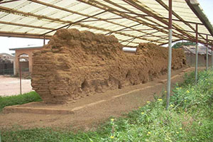
- – Gwollu Slave Defence Wall
- – Navrongo - Tono Irrigation Dam
- – Bawku Ancient Mosque
- – Swopa Hall
- – Gbelle Game Reserve
Sample Itinerary
- (10 Days / 9 Nights)
Day 1. Arrival in Ghana.
Day 2. Travel to Bolgatanga
Day 3. Naa Gwewaa Shrine
Day 4. Kulungugu Bomb Site
Day 5. Navrongo Cathedral
Day 6. Gbewaa College of Education
Day 7. Gwollu Slave Defence Wall
Day 8. Papa Crocodile Pond
Day 9. Shopping
Day 10. Free day & Departure in the Evening
UPPER EAST REGION
Upper East Region The Upper East Region is located in North Eastern Ghana and is the second smallest of 10 administrative regions in Ghana, occupying a total land surface of 8,842 square kilometers or 2.7 per cent of the total land area of Ghana.
The Upper East regional capital is Bolgatanga, sometimes referred to as Bolga. Other major towns in the region include Navrongo, Paga,Garu Tempani,Pusiga, Binduri,Fumbisi, Tongo, Bongo, Nangodi Bawku and Zebilla.
GEOGRAPHY Location and size The Upper East region is located in the north-eastern corner of Ghana. It lies between longitude 0° and 1° west, and latitudes 10° 30’N and 11°N. The region shares boundaries with Burkina Faso to the north, Togo to the east, Upper West Region to the west, and the Northern Region to the south.
The Upper East region is divided into 10 districts and 3-Municipals assemblies each headed by a district/municipal chief executive.
DEMOGRAPHICS
Population The population is primarily rural (79%) and scattered in dispersed settlements. The rural population was 87.1 percent in 1984 and 84.3% in 2000. There was, thus, a 2.8 percentage point reduction in the rural share of the population between 1984 and 2000 and a further 5.3 percent reduction between 2000 and 2010.[2] With only 21 per cent of the population living in urban areas, the region is the least urbanized in Ghana. The 2010 population census put the population of the Region at 1,046,545.
The dense of the population is concentrated in Bolgatanga.
TOPOGRAPHY, CLIMATE AND VEGETATION
There are two seasons, the rainy season which start from May-October and the Harmattan season which begins from November to April. The mean annual rainfall during this period is between 800 mm and 1100 mm.
The rainfall is erratic spatially in duration. The harmattan season is characterized by cold, dry and dusty winds. Temperatures during this period can be as low as 14 degrees centigrade at night, and as high as 40 degrees centigrade during the daytime.
Humidity is, however, very low making the daytime high temperature less uncomfortable. Large areas of previously abandoned farmlands have been declared suitable for settlement and farming.
The natural vegetation is that of the savannah woodland characterized by short scattered drought-resistant trees and grass that gets burnt by bushfire or scorched by the sun during the long dry season.
Human interference with ecology is significant, resulting in near semi- arid conditions. The most common economic trees are the sheanut, dawadawa, boabab and acacia.
POLITICAL AND ADMINISTRATIVE STRUCTURE
The region is administered politically from Bolgatanga. The main administrative structure at the regional level is the Regional Co-ordinating Council (RCC), headed by the Regional Minister.
Other members of the RCC include representatives from each district assembly, regional heads of decentralized ministries, and representatives of the Regional House of Chiefs. There is also effective traditional leadership and vibrant Youth Development Associations to facilitate efficient and effective mobilization of local resources.
Within the region there are currently twelve (12) political parliamentary constituencies. ECONOMIC ACTIVITIES The region’s economy is based on agriculture, primarily cattle and cereals like millet, sorghum and rice. The region is also known for its handicrafts and a locally brewed beer known as Pito. The market at Bolga has a long history.
The ancient trans- Saharan trade routes from Mali, which passed through Burkina Faso, was joined in Bolga by a second route, from northern Nigeria through Bawku, and continues down to Tamale and southern Ghana.
At the Bolga market, visitors can buy straw hats, baskets, leather goods, metal goods, and traditional clothing.
The region’s soil is “upland soil” mainly developed from granite rocks. It is shallow and low in soil fertility, weak with low organic matter content, and predominantly coarse textured. Erosion is a problem.
Valley areas have soils ranging from sandy candy loams to salty clays. They have higher natural fertility but are more difficult to till and are prone to seasonal water logging and floods.
Drainage is mainly by the Red Volta and Sissili Rivers (Regional Coordinating Unit, 2003).The main occupations in the region in order of magnitude are, agriculture and related work (65.9%), production and transport equipment work (14.5%), sales work (9.5%) service work (3.9%), and professional, technical and related work (3.8%) per cent and others(2.4%).
The occupational structure of the region is thus not very diverse.
CULTURE/LANGUAGE/ ETHNIC GROUPS/ TRIBES
Culture of the region is projected through the medium of arts, music and dance while. LANGUAGE: There are more than 8 language and major dialects, including Gurune (frafra), Nankani, kassem, Taleni, Nadam, Kusal, Buili and Bisah.
The major ethnic groups in the region are; 1. Gurusi (frafra)-Bolgatanga 2. Kassena- Nankani- Navrongo/Paga, Mirigu, Sirigu 3. Kusasi/Bisah-Bawku, Zebilla, Garu, Pusiga 4. Bonsi-Bongo 5. Talensi- Tongo 6. Nadams-Nangodi 7. Buillsa-Sandema, Fumbisi
Adaakoya Festival Adaakoya is celebrated at Bolgatanga and Zuarungu by the Gurunsis. Adaakoya festival is held between December / January each year. The festival serves to give thanks to the gods for good harvest.
The mode of celebration is through various sacrifices followed by drumming and dancing. The climax is a durbar of the chiefs and people.
Electricity The towns on the national grid in the region include Bolgatanga, Navrongo, Sandema, Bawku, Zebilla Chuchuliga, Chiana, Pwalugu, Tongo, Kongo, Garu, Bongo and Nangodi.
Energy Fuel wood for cooking is scarce and the dried stem of sorghum and millet are mostly used for that purpose. The use of liquefied petroleum gas is being encouraged. There is a fuel depot at Bolgatanga for the storage of petroleum products.
Water supply About 51 per cent of the region’s population has access to potable drinking water. Almost two thousand hand pumps (boreholes) and a number of hand-dug wells serve majority of the rural populations.
While water treated for consumption in Bolgatanga is from the Vea Dam, the pipe-born water systems in the other townships make use of mechanised boreholes. The dam is also used for irrigation and fish farming.
Health
There are hospitals and health centres all over the region
SAFETY/SECURITY
There are police stations in all the districts and municipals capitals that provide security and safety. Also, police presence can be noticed at some vantage places. That apart, police patrols have been provided on highways in the region.
We have fire service department in all the 13 districts capitals.
Gologo/Golib festival The Gologo or Golib festival is celebrated by the Talensis who reside at Tengzug. The period of celebration is March/April every year. The significance of the festival is to appeal to the gods for good rains and successful farming seasons.
MAJOR FESTIVALS
FAO FESTIVAL Is a festival celebrated mostly in December but not February. It is a thanksgiving festival after harvest.
KUURE FESTIVAL Kuure is the festival of the people of Zaare who are Predominantly blacksmiths. The Festival symbolizes the “Kuure” which is the Gurune word for hoe. The hoe is their main tool for farming and for that matter, livelihood. It is usually held in January/ February every year. It is Characterized by various sacrifices and later followed by drumming and dancing.
DAMBA FESTIVAL
The Damba festival is celebrated by the Mamprusis. The main venue of the celebration is Bawku and neighbouring towns. It is celebrated between July and August. The Significance of Damba festival is to mark the birth of the Prophet Mohammed.
SAMANPIID FESTIVAL
It is a harvest and thanksgiving festival celebrated by the Kusasi in the Bawku east and Bawku West District. It is mostly celebrated in December.
TENGANA FESTIVA:
Tengana Festival As a thanksgiving offering, the Tengana Festival is held at Balungu, Winkongo and Pwalugu, all in the Tongo Traditional Area. It is one of the festivals for the Telensis. It is climaxed by traditional music and dancing amidst general merry-making.
Boaram Festival Boaram is the festival for the Talensis in the Bongo tradition Area. It is held between October and November every year. Its significance is to give thanks to the gods for a good season and lots of sacrifices are made to the gods.
FEOK FESTIVAL
This is the annual festival of the people of Sandema in the Builsa. It is held in December. It is celebrated through the display of war dance by various communities. There is also a durbar of the chiefs and people to climax it.
How to get there Bolgatanga is north Tamale and it takes 2 to 3 hours depending on the vehicle on newly constructed asphalt road through Walewale. Alternatively you can also come through Navrongo if you are from Burkina Faso.
Getting Around It is easier to get around in this town with some of the teenagers who are very eager, enthusiastic and proud of their town. Be sure to rent a Motorbike for easy movement and just for the fun of it.
TOURISM ATTRACTIONS IN THE REGION CULTURAL AND HISTORICAL HERITAGE
BOLGATANGA MARKET
This market is renowned for straw hats, baskets, leather goods, metal goods, and traditional clothing. Enjoy the lively atmosphere, and bargain with traders from the region, Mali, and Burkina Faso for good prices. The market used to be part of trans-Saharan trade routes.
KULUNGUGU BOMB SITE
Kulungugu lies northwest of Bawku. On August 1st 1962, Dr. Kwame Nkrumah, the first President of Ghana made a stopover at Kulungugu after a visit to Upper Volta (now Burkina Faso), to meet with the then President, Maurice Yameogo. A reception was held in his honour near a local school. A school girl was presenting a bouquet of flowers to Dr. Kwame Nkrumah which had a bomb planted in it.
The girl was killed and quite a number of people sustained severe injuries. Dr. Nkrumah himself was allegedly hit at the back of the head. A monument in memory of Dr. Nkrumah has been erected at the site.
PAGA TOWN
Paga is the major entry point on the Ghana-Burkina Faso border. It is 40 km and a 45-minute drive from Bolga. Paga offers perhaps the most vivid insight into the heritage and vestiges of the Trans-Atlantic Slave Trade.
A slave camp near the sacred crocodile pond provides evidence of the harsh realities of the captives. Holes dug in rocks, which served, as drinking troughs and eating bowls are very visible, as are slabs of rocks that served as auction blocks and graves.
NAVRONGO -TONO IRRIGATION DAM
En route to Navrongo is the Tono Irrigation Dam used by local out growers of vegetables and rice. The dam offers opportunities for water sports and relaxation.
NAA GBEWAA SHRINE AT PUSIGA
The shrine is located close to the Gbewaa college of Education at Pusiga. The site of the shrine is significant for three main reasons: to satisfy curiosity, as a spiritual spot and a source of paying homage to ancestors.
Naa Gbewaa is the founder of the Mole- Dagbon tribes. The belief is that the shrine was closely linked to the popular Songhai Empire and has really been in existence since the 14th century. Legend has it that Naa Gbewaa never died but actually vanished at a spot at the shrine. According to history, Naa Gbewaa had three sons and a daughter.
The daughter left home and ran off with a Moshie hunter whom she married later. Their children became the chiefs and kings of the Moshie Kingdom. The three sons later became kings of Mamprusi, Nanumba and Dagbon kingdoms which up to now renew their bond with their ancestors through the Pusiga Naba.
Accessibility from Bawku to Pusiga is good and the site of the shrine is not very far from the centre of Pusiga town. There are hotels in Bawku for tourists and travelers.
NAVRONGO CATHEDRAL
Thirty minute drive and 18km northwest of Bolgatanga is Navrongo. The key attraction in this town, which is also a major educational center, is the architecturally unique Catholic Cathedral. Also Known as Our Lady of Seven Sorrows, was built in 1906 and is believed to be the last remaining Mud cathedral in, it has mud walls and a traditionally decorated interior.
The Catholic Church has recently initiated conservation measures to preserve this icon. Tourists interested in the Christian heritage of Northern Ghana will enjoy touring this Cathedral.
MOSQUE
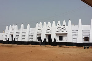
This ancient mosque, about southeast of Bawku, was built by Muslim missionaries. It showcases typical Sudanese architecture from about 300 years ago.
FOREST RESERVES
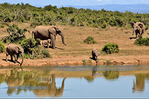
In Siring, zebilla, Guri in the Bawku area, wildlife species such as the elephant and roan antelope can be found here. A corridor where elephants and other wildlife from Burkina Faso reserved used during the dry season in search for water and grass.
WILDLIFE AND NATURE RESERVES
PAGA CROCODILE POND
Paga is located at the border between Ghana and Burkina Faso. It is 40kms from Bolgatanga and 12kms from Navrongo. Paga is noted for its sacred pond, which is a sanctuary for crocodiles. The crocodiles are said to be totems for the people of Kassena, who reside in Paga and the surrounding communities.
It is believed that each native of Paga has a corresponding crocodile representing each person’s soul. Local tradition has it that there have been actual instances when deaths of important personalities in the community coincided with that of some crocodiles.
The reptiles are normally enticed out of the pond by the whistling of the caretaker and the brandishing of a fowl, which the crocodiles quickly snatch with their snouts. If you are courageous, you can sit on, or hold the beast’s tail for a good camera pose.
The caretaker charges a fee for the fowl and basic interpretation. Pio’s palace is worth visiting.
SIRIGU POTTERY WOMEN AND TRADITIONAL ARTS
Sirigu is the place to visit for anyone interested in pottery and local art. Sirigu is famous for its local wall decorations. Wall decorations are common in Northern Ghana, but have been perfected in Sirigu.
The centre was established in 1997 to preserve the art and culture of the people of Sirigu. Visitors to Sirigu can browse the wide selection of pottery, crafts and artwork in SWOPA Hall. Sirigu offers tours to surrounding homes to see the decorations at first hand, and tours of the village are also possible.
The best way to experience Sirigu is through one of the ‘Be Part of the Art’ workshops. Visitors can choose to learn how to make pottery, basketry or wall designs. House and village tours are part of the workshop package and guests can stay in the SWOPA Guest House. Sirigu is located 36km north of Bolgatanga.
TONGO ROCKS AND TENGZUG SHRINE
The oracle here, consulted mainly by the other tribes, resides in a cave. People come to ask predictions, advice, and cures from the oracle. Pilgrims make ritual stops on their ascent to the cave, and may also make offerings at the cave opening. Originally, locals carrying a fetish stone were attacked at this spot by a swarm of bees. This event caused the people to venerate the place as powerful.
WIDNABA ECO-VILLAGE
The Winaba hills are corridor for elephants and host of other wildlife. The place is ideally located for birds viewing. It is also bordered by the Ghana Burkina Faso border by the river White Volta on the north.
Activities in the area are hiking, mountain climbing, biking, birds watching and learning about the cultures of the Kusasis and the Fulani tribes which inhabit the valley.
EDUCATIONAL INSTITUTIONS
University of Development Studies – Navrongo Bolgatanga Polytechnic – Sumbrungu:
• Health Research Centre-Navrongo
• Millar Institute for Transdisciplinary and Development Studies (MITDS)
• St. John Bosco College Of Education- Navrongo
• Gbewaa College Of Education-Pusiga
• Bolgatanga Nursing Training College
• Midwifing Training College-Bolgatanga
• Health Assistant Training School- Navrongo
• Community Health Trainng School- Navrongo
• Bolgatanga Senior High School – Winkogo
• Navrongo Senior High School-Navrongo
• Bawku Senior High School-Bawku
• Bolgatanga Girls Senior High School – Bolgatanga
• Sandema Senior High School-Sandema
• Bongo senior high schools
• Zebilla SHS/TCH
Transport System (Air) One can travel by air daily in an hour from Accra to Tamale then on shuttle bus to Bolgatanga in the upper east region.
Banks and Forex Bureau Foreign currencies are freely exchanged at forex bureau and banks.
Hotels Hotels are classified according to the international star rated system with 2 star as the highest in the region. In addition, there are local budget hotels with minimum standards of sanitation and comfort.
Restaurant There is a wide selection of restaurants that offer both continental and local dishes. Visitors are encouraged to sample delicious and local dishes at the local restaurants (chop bars).
Go Back


